Priority opportunity for the purchaser of the Solar
Keep the estate whole.
Candosa and Valverde complete the landscape around the manor house: 26.7 hectares of field, native woodland, ecological plantation and elevated views across the valley.
One historic landscape
Two distinct properties, offered first to one buyer.
The purchaser of the Solar has first priority to acquire Candosa, Valverde, or both. Candosa lies directly across the road from the manor house; Valverde rises above the valley with a privileged view back towards it.
Neither property is intended to be offered to another purchaser until the buyer of the Solar has expressly declined the opportunity.
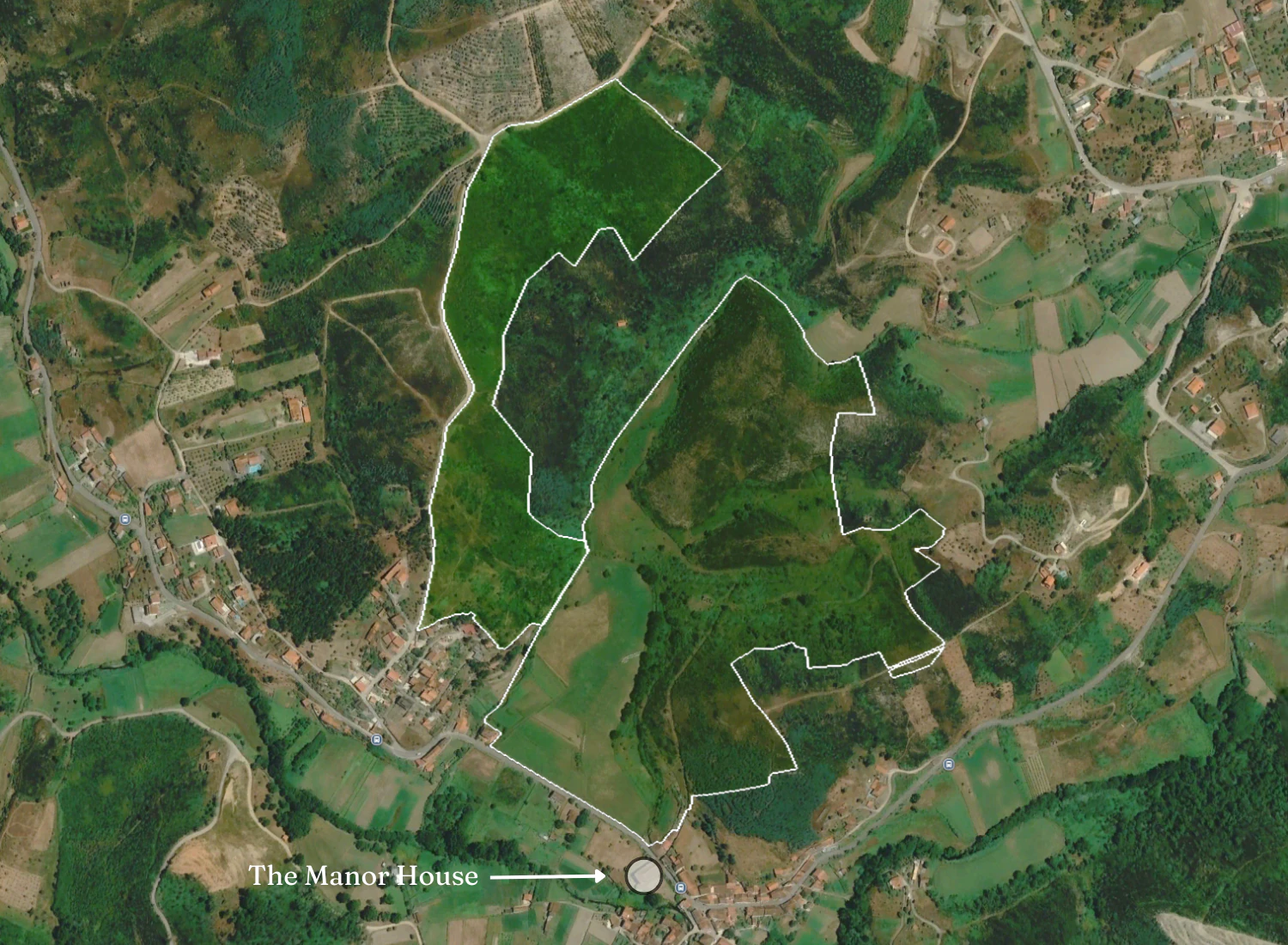
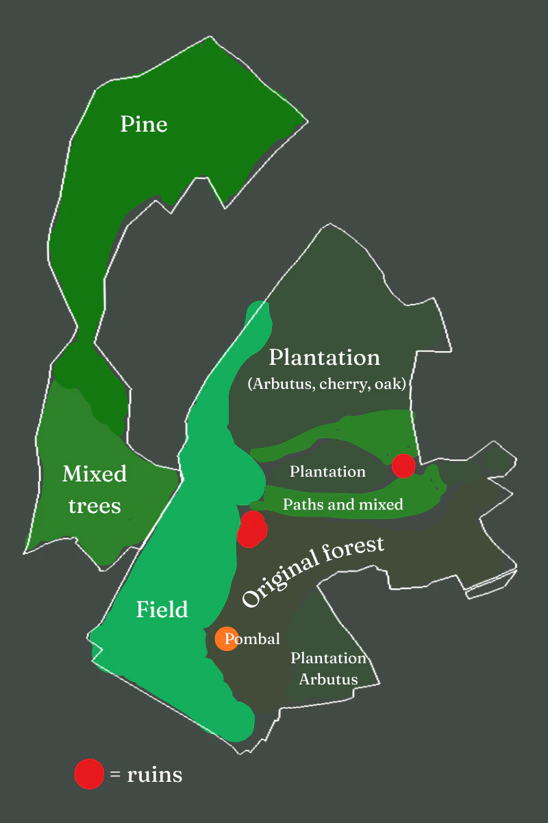 Landscape character · supplied field observations
The complete setting
The field, the forest and the view home.
Candosa preserves the Solar's agricultural and woodland setting. Valverde protects the high ground and creates a visual connection back towards the house. Each has its own identity; together they retain the scale and coherence of the former estate.
Reserved opportunity
First priority belongs to the buyer of the Solar.
Candosa and Valverde may be added independently or together. Neither property is intended to be offered elsewhere until the Solar buyer has expressly declined it.
01 · Candosa
€215,000
Solar-buyer price- Area
- 183,581 m²
- Separate reference
- €249,000
- Priority advantage
- €34,000
02 · Valverde
€139,000
Solar-buyer price- Area
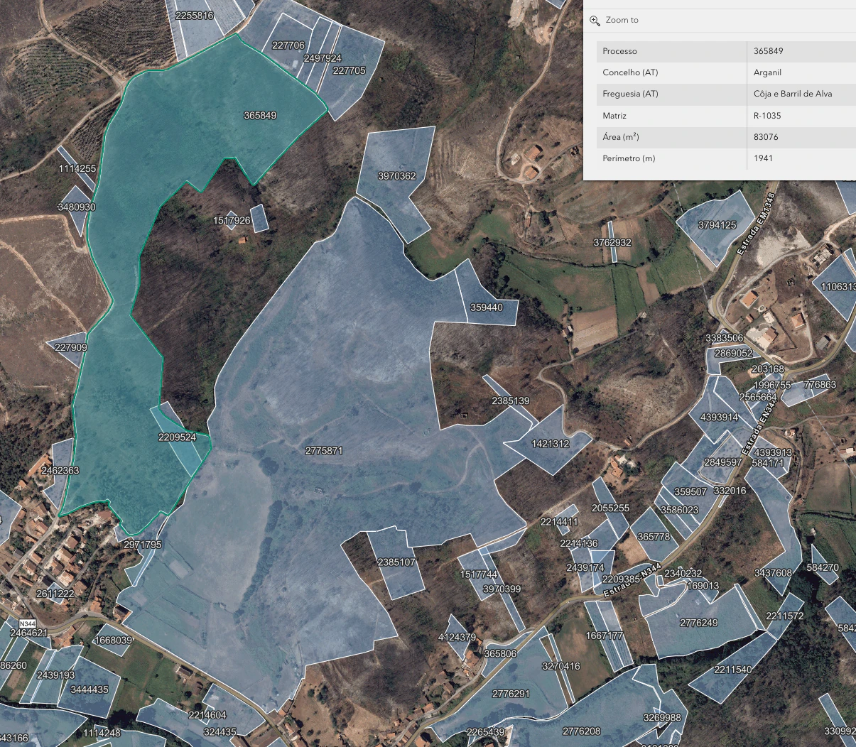
- 83,076 m²
- Separate reference
- €149,000
- Priority advantage
- €10,000
01 + 02 · The complete landscape
€354,000
Priority price for both- Combined area
- 266,657 m²
- Separate references
- €398,000
- Total advantage
- €44,000
01 Candosa
From fertile field to native forest.
Directly across the road from the Solar, Candosa is the principal landholding: 18.36 hectares of productive ground, mature woodland, ecological restoration, private paths and registered rural ruins.
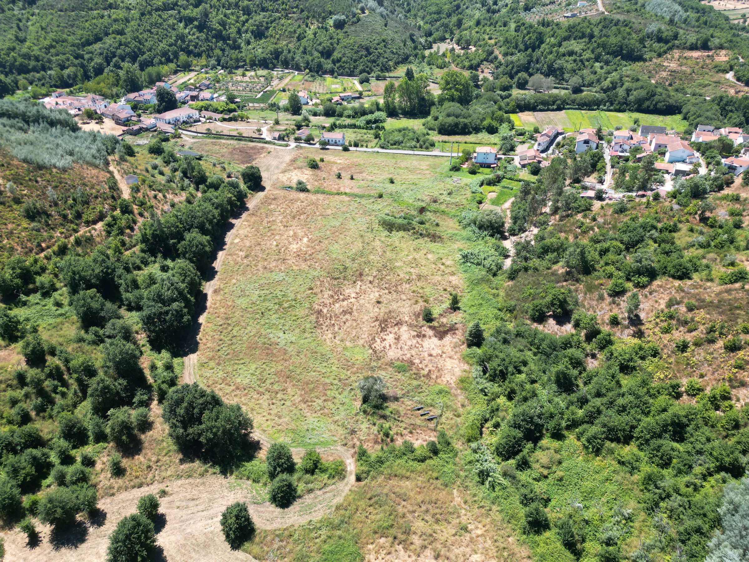
The agricultural field
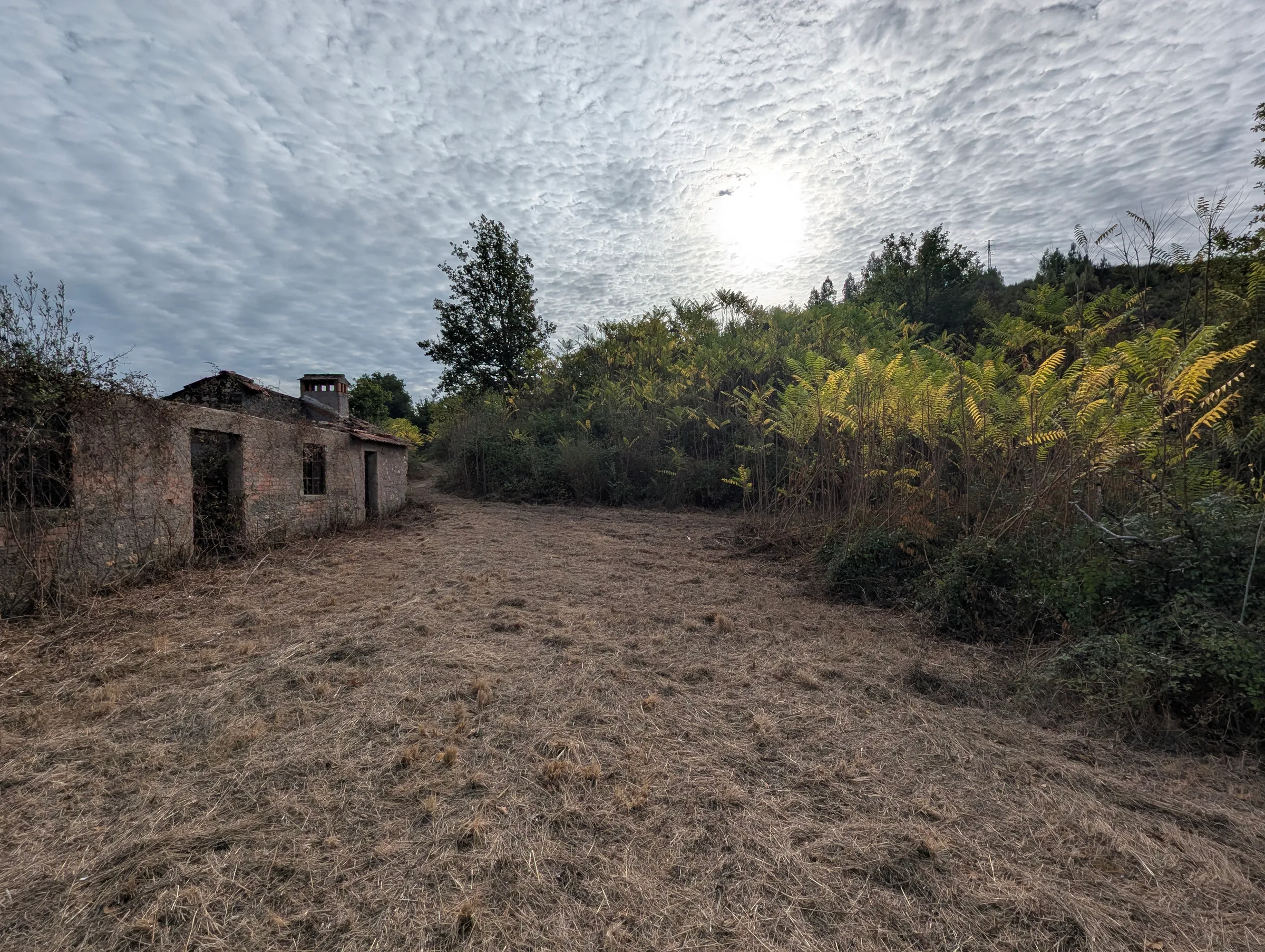
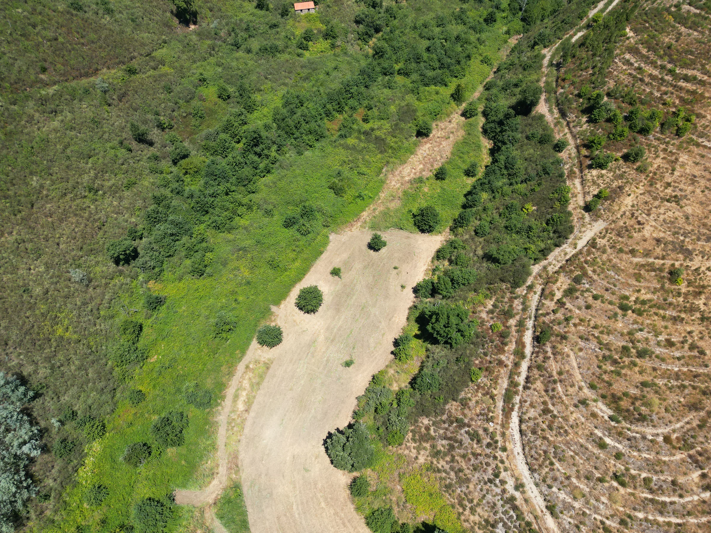
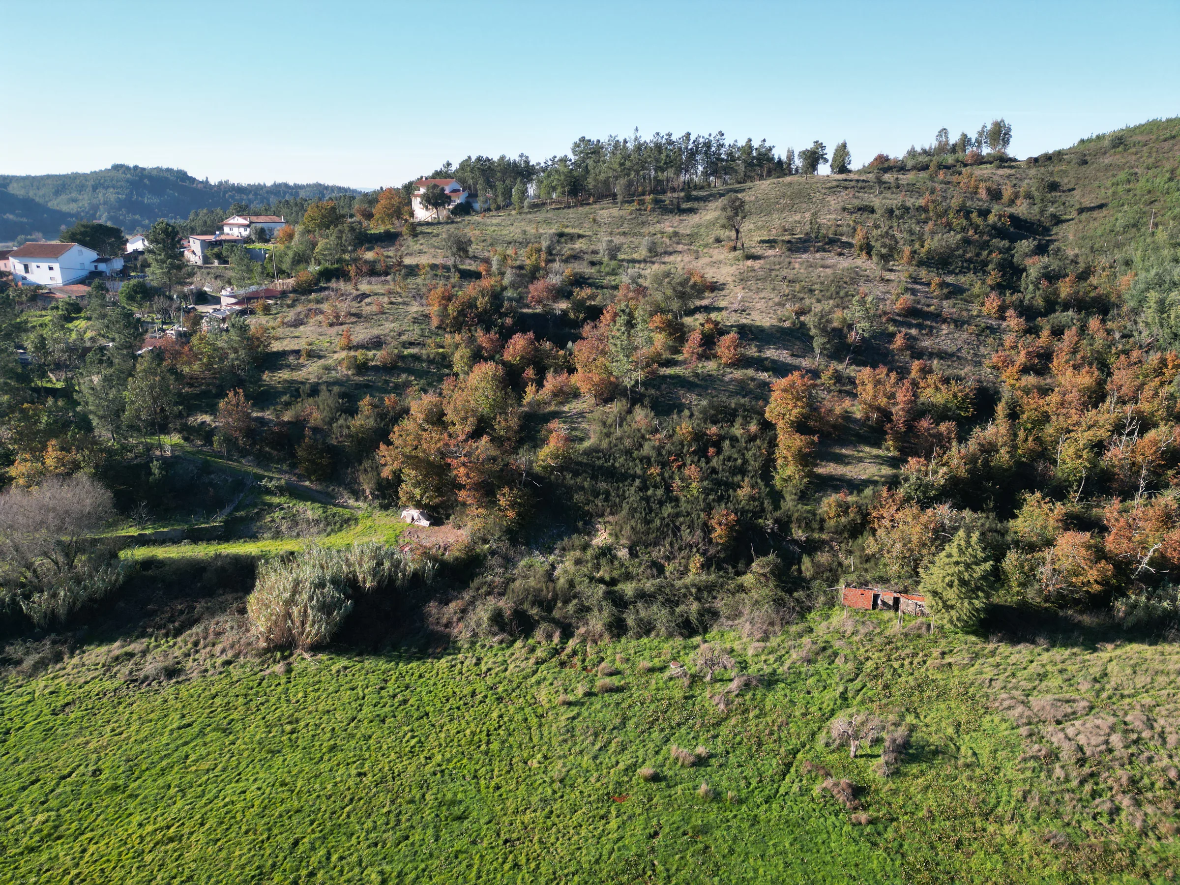
The broad field beside the road is good agricultural land with a small number of fruit trees. Once worked by local people, it is now resting and remains the open, productive foreground to the estate.
Original oak woodland
Beyond the field, the hillside folds into mature, naturally established woodland, predominantly oak. The paths through it are intimate, shaded and among the most magical parts of Candosa.
A living permaculture project
The northern restoration plantation was designed around permaculture ideas and formed the owner's final project for a permaculture course. Strawberry tree, oak and wild cherry were planted along water-retaining swales to rebuild vegetation and reduce erosion. Irrigation during the first three years gave the young trees a strong start.
Three registered rural ruins
The property includes three registered rural ruins: the remains of a substantial house beside its traditional eira, a smaller stone ruin and a circular pombal. Their registration may offer restoration potential, subject to due diligence and all appropriate approvals. They are not presented as habitable buildings.
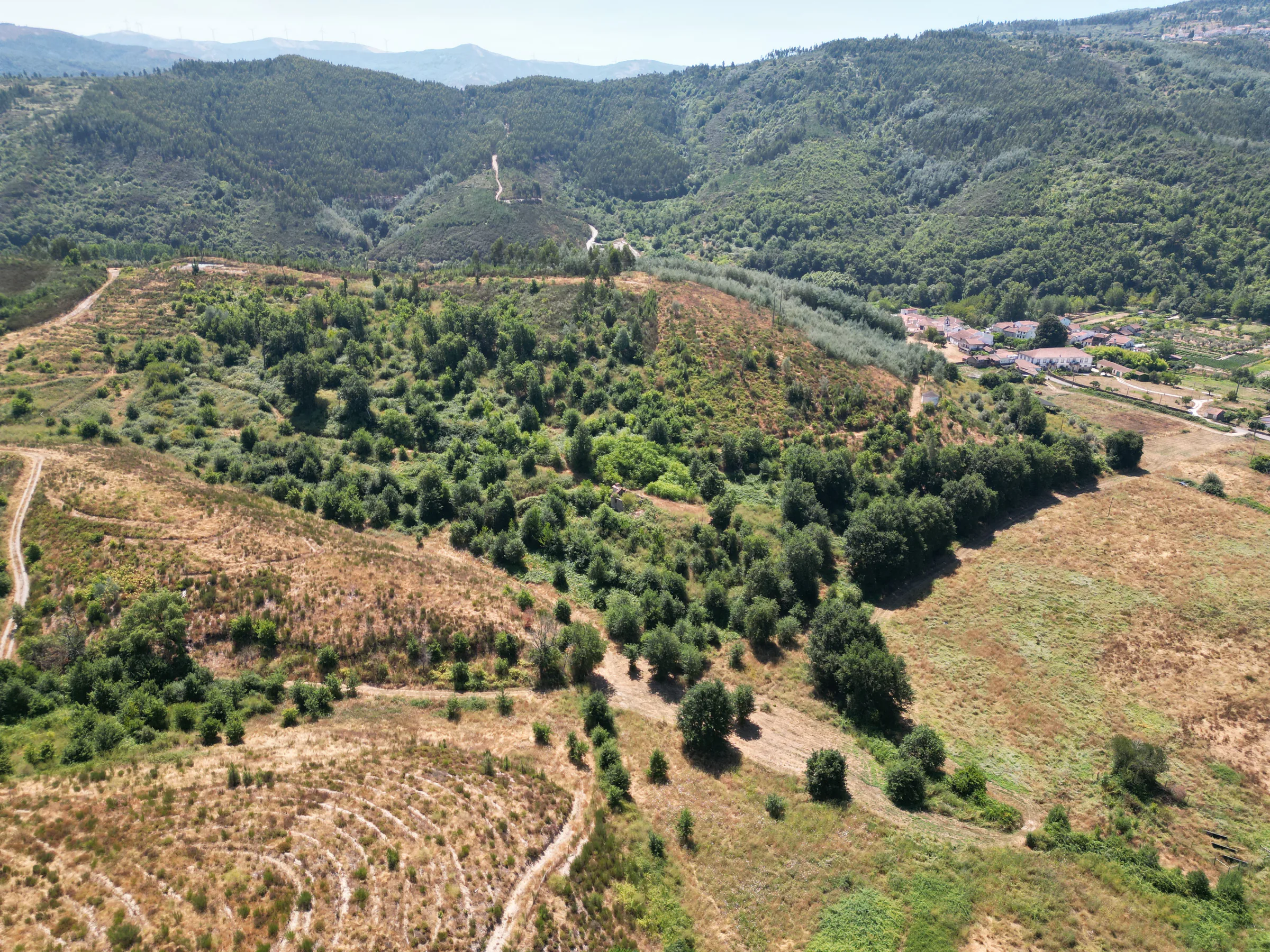
“Candosa is not simply more land. It preserves the agricultural origins, native landscape and future possibilities of the Solar.”
02 Valverde
The elevated view back to the Solar.
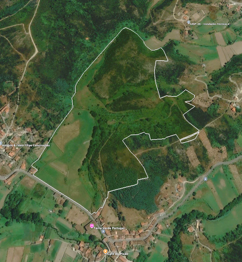
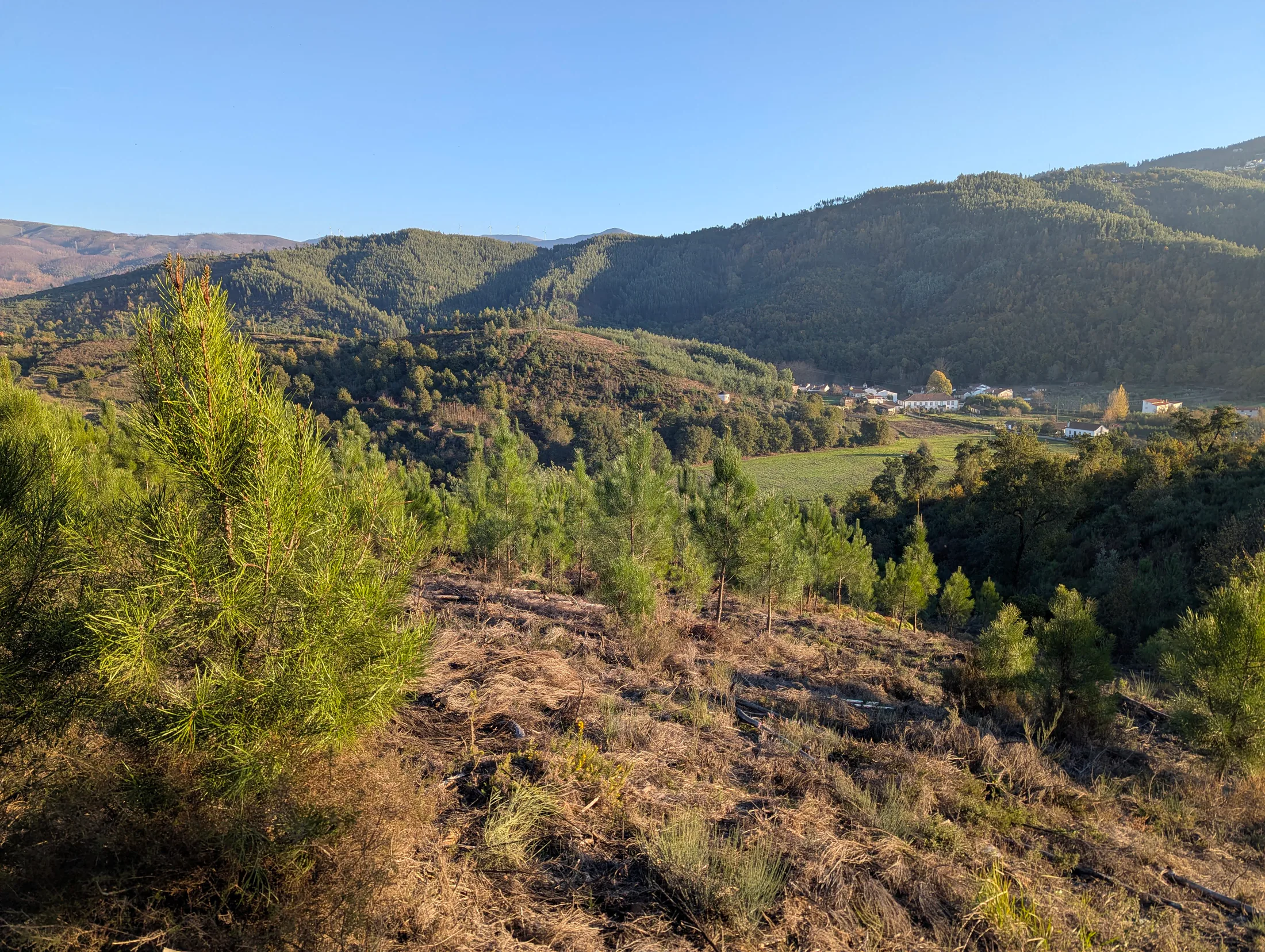
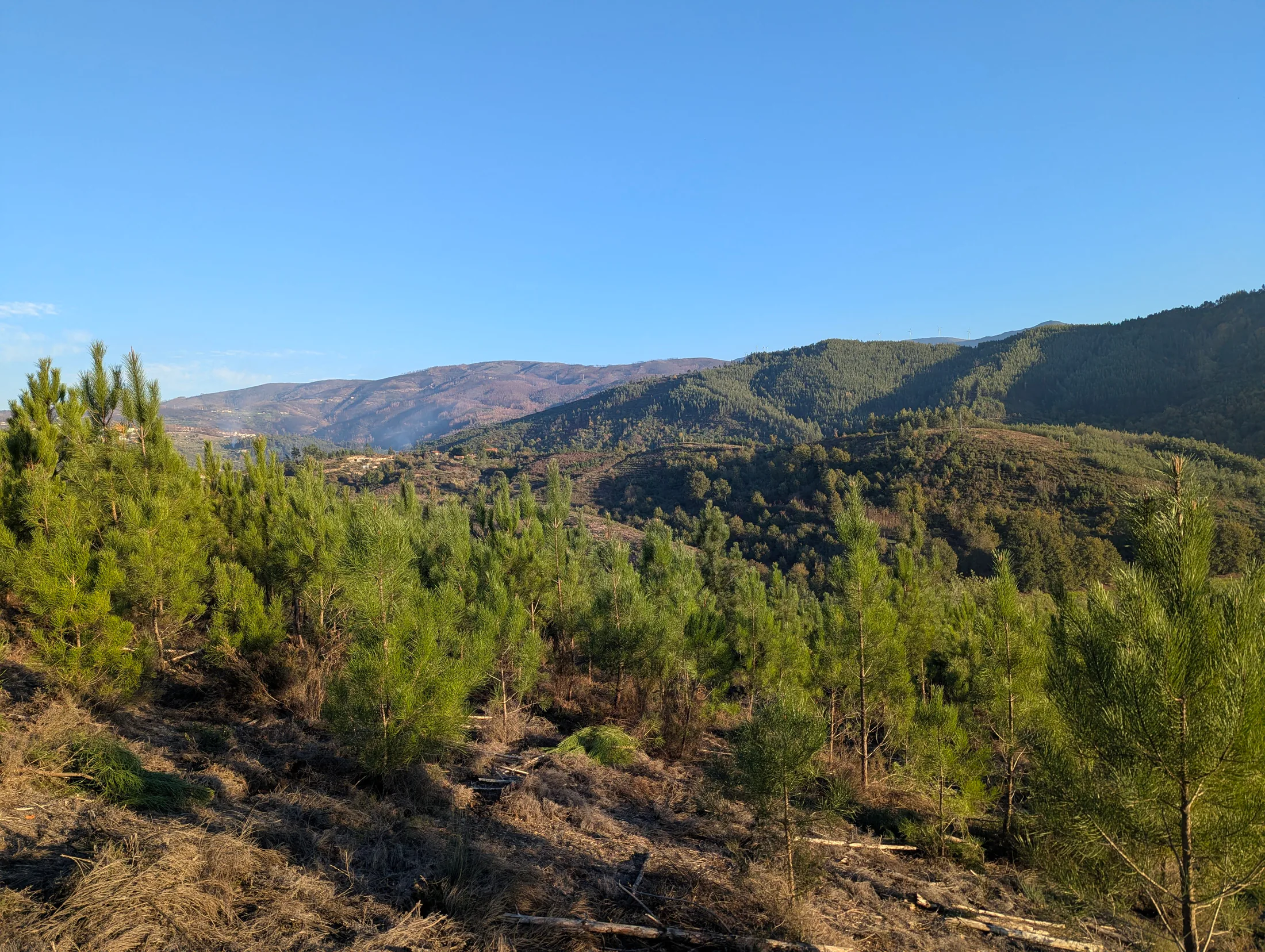
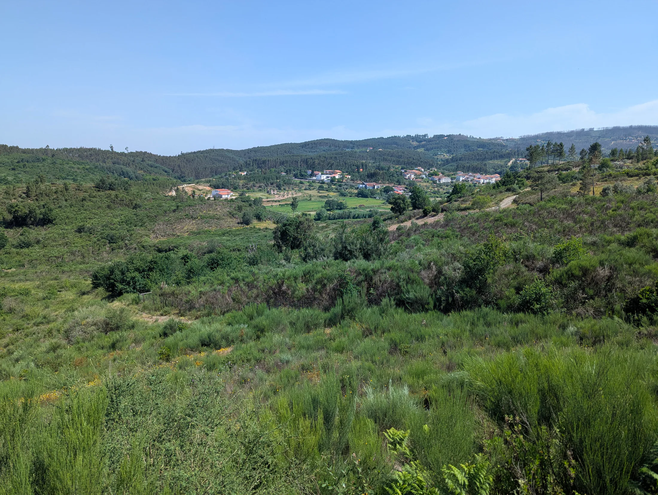
Valverde occupies 8.31 hectares of high ground, woodland and former grazing land. Its defining experience is the outlook: the valley, village and manor house revealed below.
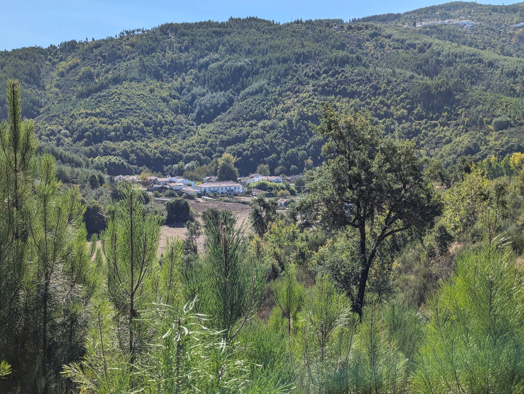 The Solar seen from Valverde
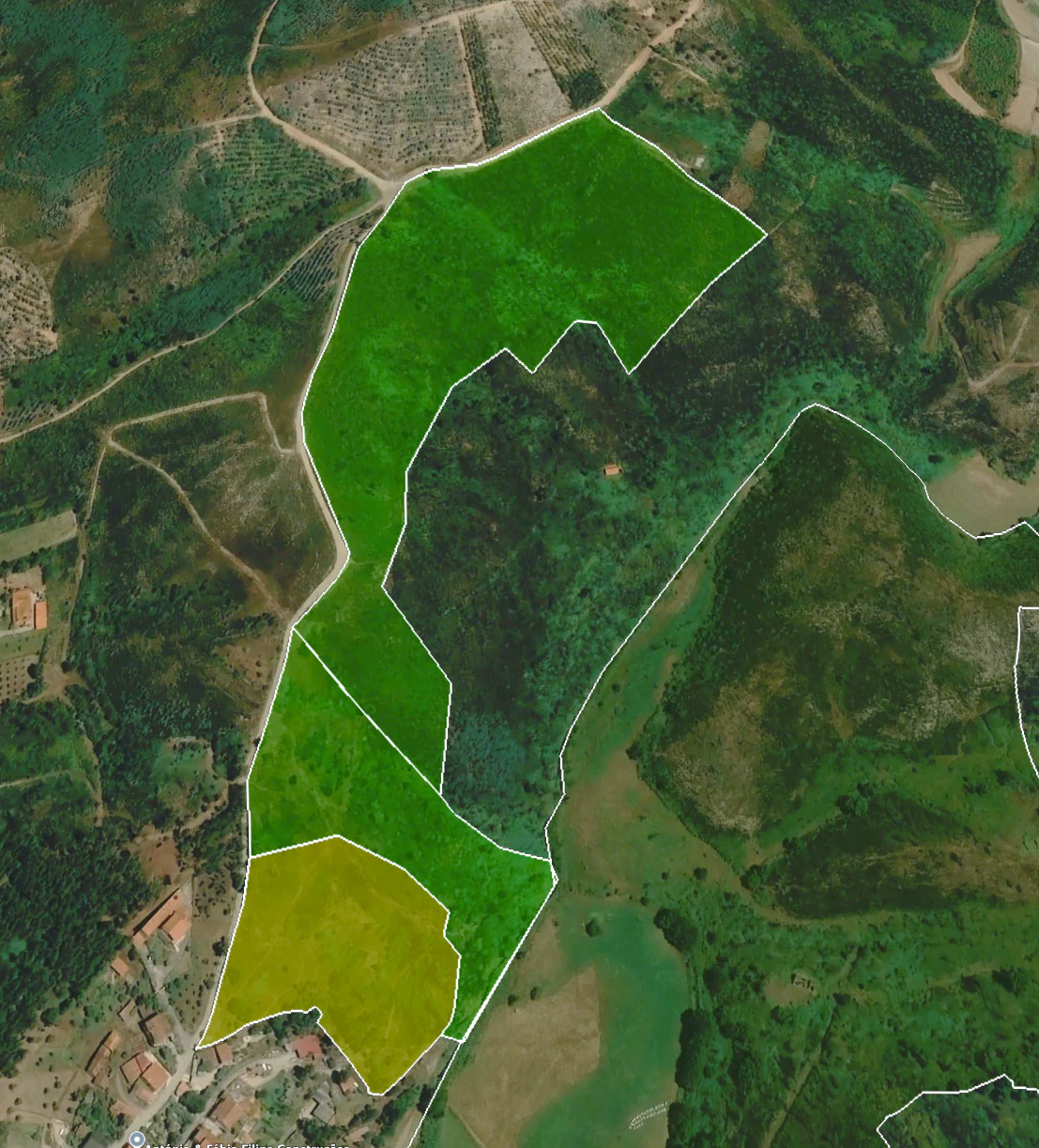 Valverde boundary · southern urban-designated section shown in ochre
Cleaned pine woodland
The upper ground is principally pine with areas of mixed vegetation. Recent cleaning has opened the woodland and made the elevated landscape more accessible.
Mixed land and former grazing
The southern slopes combine open vegetation, mixed trees and ground formerly used for sheep grazing.
A public dirt road
The road following the edge of Valverde is public, an important element in considering access and any future proposal.
An urban-designated southern section
The supplied planning work identifies an urban section at the southern edge, with an indicated building index of 1.35. This would be confirmed as part of a formal project.
Planning context
Positive early conversations, with formal design still ahead.
No formal building application has yet been submitted. Informal conversations with architects at the Câmara Municipal de Arganil have been positive and indicate that a well-prepared proposal can be supported. The next owner can develop the concept with their architect and seek the project-specific municipal and other approvals that apply.
01Land classification
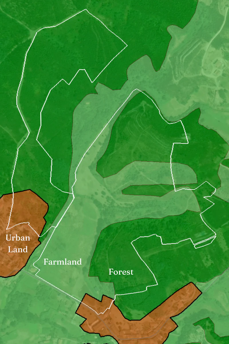
The supplied classification work distinguishes farmland, forest and the urban-designated section of Valverde.
02RAN · agricultural reserve
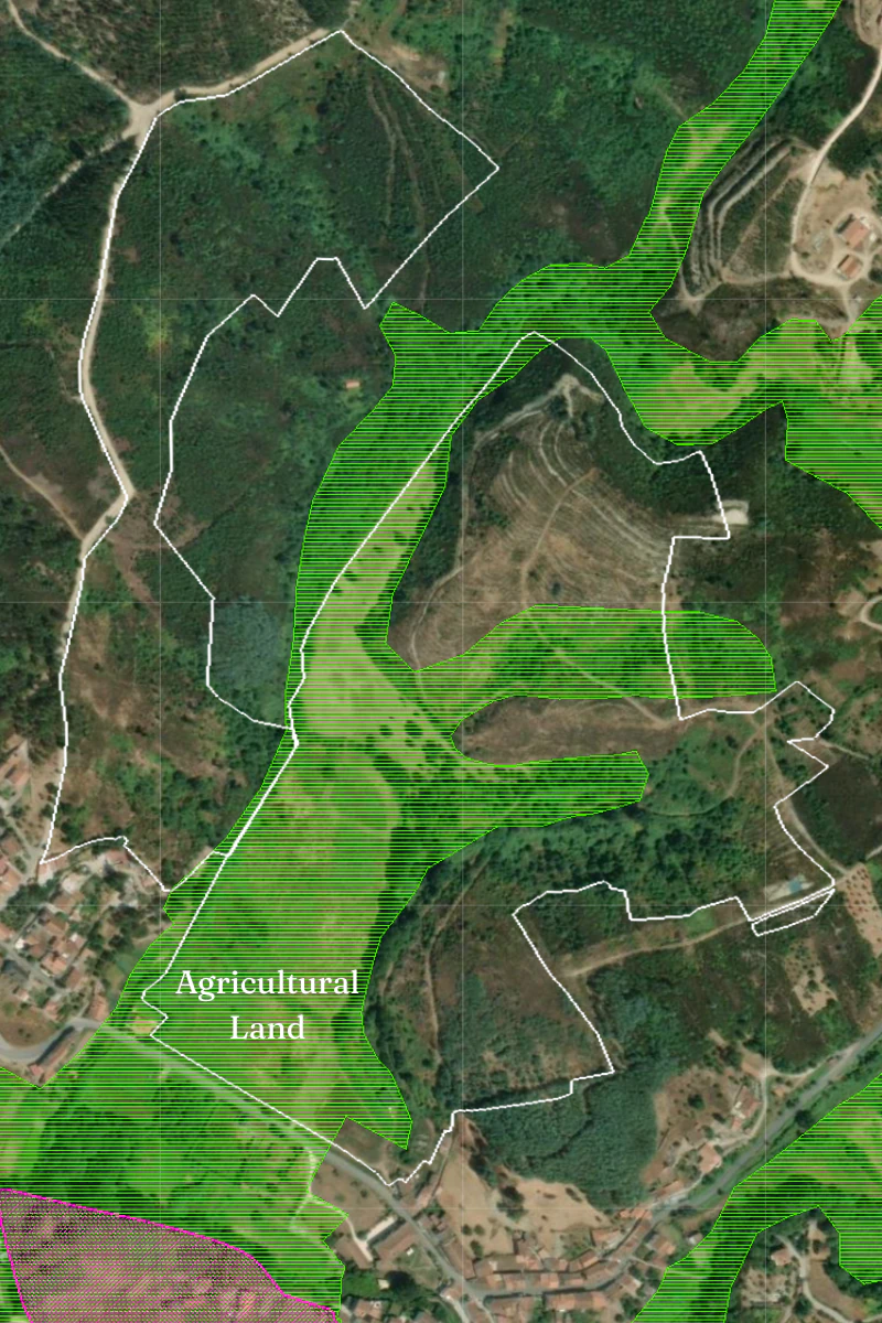
The valley field is treated as agricultural ground. It is presented for cultivation and landscape value rather than as a building location.
03REN · water and erosion
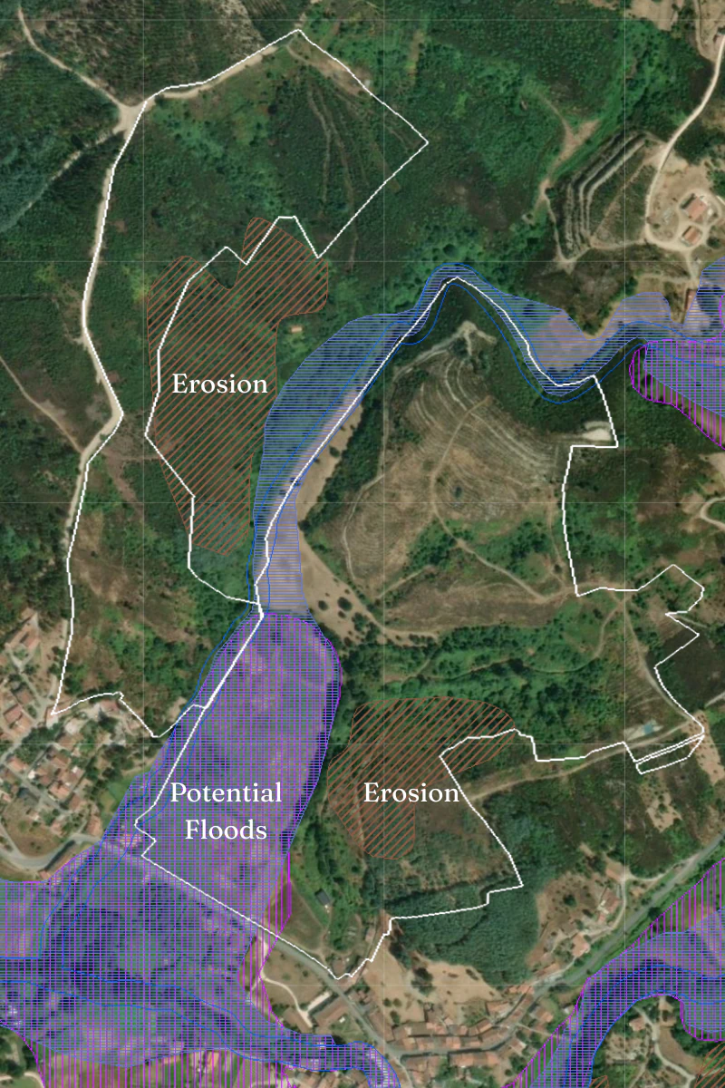
Potential flood areas follow the low field and watercourse; mapped erosion considerations affect limited elevated areas.
04Fire-hazard context
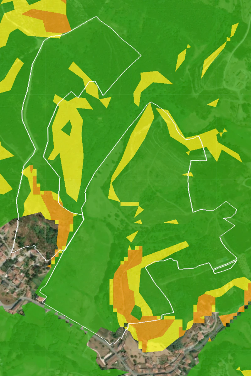
The supplied hazard map is part of the due-diligence picture and would inform siting, access and vegetation management.
Areas and boundaries
BUPi guides the current cadastral picture.
The surface areas used here are those in the current BUPi registrations: 183,581 m² for Candosa and 83,076 m² for Valverde. The supplied KML boundaries closely follow those registrations.
Older finance documents retain historic, smaller measurements while Portugal's cadastral reconciliation continues. A purchaser may commission a topographic survey to establish the physical boundaries precisely and support any future update of the official records.
Both registrations can be viewed directly on thepublic BUPi map .
All planning, cadastral and development information is presented for orientation and remains subject to the buyer's legal and technical due diligence and to formal approvals for a specific project.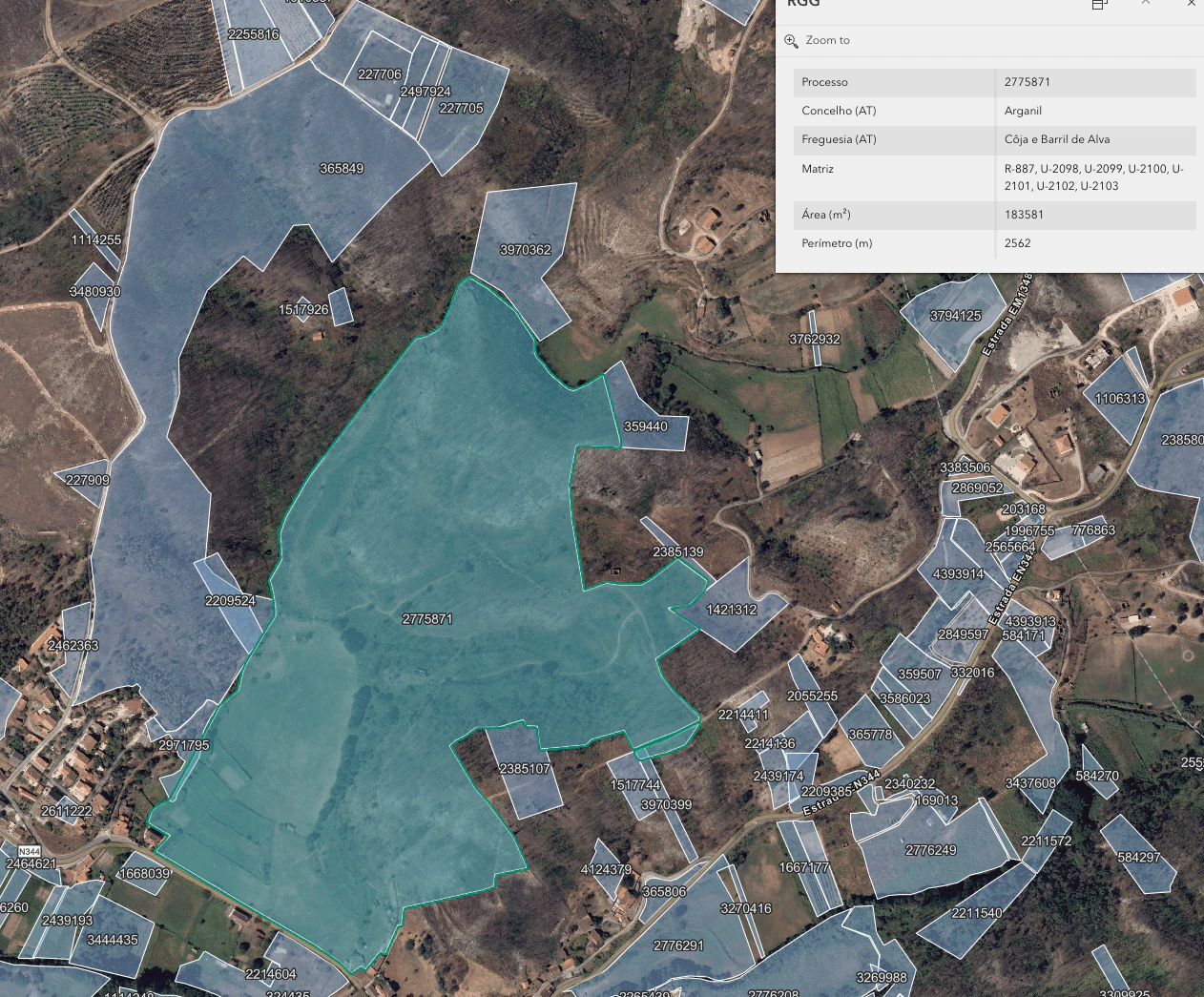
Candosa · Valverde · The Solar
See the estate as a whole.
Contact your real estate agent for full documentation or to arrange a private visit to walk the land.